Tuesday, September 30, 2008

City of Sails

After a relaxing and wonderful time in the Cook’s we arrived at the Auckland International Airport. This time it was a daytime flight and the time difference was negligible so we didn’t get jet lag (as on the previous flights). We had arranged pick up from the airport and accommodation for the first night close by, so our arrival went smoothly. The Airport Skyway Lodge was cozy even though it hadn’t been ranked so well on the internet. The price/quality ratio was good indeed.

The first impression of New Zealand was great: The airport area really seems to be one of the best in the world, at least what we have seen (contrary to LAX). Everything was marked properly, people were helpful and we passed customs and bio-security smoothly without queuing. They even gave all arriving passengers free coffee and tea while waiting for the baggage (which came without delays). Free hint: the booze was really cheap in the tax-free shop so if you are coming here we recommended you use this opportunity (e.g. Captain Morgan’s rum for only 7€/liter)!

About our week in Auckland: We did quite a lot of walking around the city soaking up the atmosphere and getting to know its places. Here are a few examples of what we did and which things-to-do are almost compulsory if you come to Auckland: First of all, start by wandering around and along Queen Street and get to know the Sky City area. Before sunset head to the Sky Tower, take the elevator to the top and you’ll get a good view of the city! It is well worth the $18 backpacker price, but you won’t regret paying the full admission either ($25). The tower is a great place to start your Auckland exploration as it gives a good perspective of the distances between different areas (Auckland is a fantastic city because you can easily get from point A to point B by walking, at least if you don’t venture too far away from downtown).

Evening lights of Auckland viewed from the Sky Tower

Next you should visit the Lion brewery (noon tour). The tour included a good presentation of the history of beer from ancient days to the present. And after you have walked through the halls and learned how hops, barley, yeast and pure water affect the taste and how important it is that the product always tastes the same (contrary to wines, beer is always at its best when it is fresh) comes the time for the best part: Tasting! Actually you get to pour your own beer(s). After a day filled with cultural events and very stressful museum visits you can reward yourself by getting into the couch-athlete mood at a sports pub. After all, the Kiwis (as New Zealanders call themselves) are very keen followers of all kinds of sports, especially rugby! The All Blacks (the national team) are almost gods! One of the places to do this is a microbrewery/pub called Shakespeare. It is New Zealand’s first microbrewery and we discovered that the quality of the brewing is superb. They brew as much as ten own beers!

The packing hall at Lion Breweries, the largest brewery in NZ

Another thing you should absolutely do is to take a ferry over to Rangitoto. On the ferry trip you will sense the reason why Auckland is called the City of Sails. Rangitoto is a volcanic island and the lava rocks give you the feeling like you are in a desert. Even though it is just early spring here (summertime started last Sunday) the sun warms the energy absorbing rocks and makes them pretty hot. After a nice walk through the lava rocks and a nice forest trek you will reach the top of the volcano. The view is magnificent to say the least and it is a good place to have a picnic. Actually while mentioning food, let’s inform you that for certain products the prices are near half of what you pay in Finland. Subway is good example. It’s exactly half as cheap as in Finland. (Yes we did have subs in our picnic lunch on Rangitoto.)

Two Finns at the top of the volcanic Rangitoto Island with Auckland in the background

Next if you still want to enjoy good views there are more places to do this, as the city is built on seven volcanoes. One of these, Mount Eden, is one opportunity. The 360 degree panoramic view is breathtaking. On your way there you should also stroll through a couple of the beautiful parks in Auckland, like the Domain Park (where the Auckland Museum is located) or Albert Park.

Sunset on Mt Eden. Downtown Auckland and Rangitoto Island in the background.

After enjoying the mind-blasting scenery from Mount Eden you should head for the famous rugby arena called Eden Park, which is close by. Of course before doing this you have bought tickets to a game, like we did. We were lucky enough to be in the city when there was a big game between Auckland and Wellington. Last year Auckland actually won the cup, but this time Wellington proved to be worthy of its position at the top of the series. Wellington virtually crushed Auckland by 27-0! The atmosphere in the audience was, however, amazing despite the poor performance of the home team.

The cheering crowd at the Wellington - Auckland rugby game

From Auckland we headed north on a weeklong trip around the northernmost part of New Zealand. But of that you will hear in the next post.

MORE PICTURES from our days in Auckland are available on this page!

P.S. Our holiday is not over yet. The counter says 35 days and we are still sight-seeing and enjoying our time away from everyday responsibilities :) Today we left the hectic pulse of Auckland and put our backpacks down in a small, quiet and peaceful town renowned for its smoked mussels. They are excellent!

Wednesday, September 24, 2008

Rarotongan huumaa

This time our blog post is not in English. You can, however, look at our photos from Rarotonga in any language on this page.

Tervehdys (Kia Orana)!

Kirjoitellaan välillä myös tällä kaikkien kansainvälisten matkaajien omalla kielellä.
Vastaanotto Aucklandissa on ollut myönteinen ja paikka vaikuttaa kaikin puolin oivalliselta suurkaupungilta. Tervetuloa käymään! Mutta nyt vielä takaisin paratiisisaarelle ja tässä tulee ote lokikirjasta: torstai 11.9.2008

Täällä palmujen ja turkoosien laguunien suojaisissa poukamissa on oppinut arvostamaan aamuja ihan uudella tavalla: Kun aurinko paistaa verhonraoista ja ryömii aukaisemaan lasiovet, niin edessä aukeaa peilityyni laguuni, palmujen hiljalleen huojuessa verannalla. Jostain kumman syystä ei tee yhtään mieli ottaa pieniä torkkuja (toki riippumatto palmujen välissä on hyväksi havaittu rentoutumiskeino)!

Tälle torstaille oli kaavailtu leppoisampaa päivää parin trekkeilypäivän jälkeen, mutta suunnitelmiin tuli hiukkasen muutoksia. Pyöräiltyämme keskustaan (10km) huomasimme olevamme vielä kumman energisiä ja jatkoimme saman tien koko saaren ympäri (32km). Pienen ruokatauon jälkeen pääätimme lähteä takaisin Avaruaan sään ollessa oikein suosiollinen, muutaman tuulisemman päivän jälkeen. Janohan siinä tietysti tuli ja loppuiltapäivä menikin mukavasti terasseilla istuessa auringon laskuun saakka. Siitä jatkoimmekin paikalliselle urheilukalastusklubille.

32 km näitä näkymiä kelpaa katella

Kalajuttuja kuunnellessamme JBB:lle tuli tilaisuus haastaa paikallinen biljardimestari! Peli oli tiukka vaikka tappio tulikin (tosin paikallinen mestari oli jo aika tuiskeessa). Sitten seuraamme liittyikin vanhempi herrasmies ja hetken kuulumisia vaihdettuamme osottautui, että kaveri oli ollut nuorempana Cookin saarten nyrkeilymestari ja sittemmin myös saarten nopein kookospuuhun kiipeäjä! Siis paikallinen legenda ilmielävänä. Siinä jutellessemma kävi myös ilmi, että Staircase-ravintolassa olisi loistava ryhmä esiintymässä. Siispä siirryimme sinne ja herrasnies (Piri III) sanoi menevänsä kotiin lepäilemään, mutta kutsui meidät vielä kotiinsa(!) kun olisimme valmiit shown kanssa.

Tanssi- ja rumpuesitys oli vauhdikas ja aidon oloinen. Kohokohtana esityksessä oli tietysti se, että tanssijat kävivät hakemassa yleisöstä esiintyjiä paritanssityyliseen hula tanssiin ja nähtiinhän siellä sitten yksi suomalainen jääpuikkokin lavalla tropiikin kuumien rytmien sykkeessä.

Trooppisen hulatanssin pyörteissä

Palattuamme kämpille tai oikeammin Pirin kotiin (asuu lähellä majapaikkaamme), hän oli jo nukkumassa, mutta heti kun koputtelimme ovelle hän ponkaisi pystyyn käveli muitta mutkitta jääkaapille ja tarjosi meille kylmät huurteiset! Tämä ele siis ennen kuin olimme edes kynnystä ylittäneet!

Hänellä oli hienot albumit täynnä valokuvia, joita turistit olivat hänelle lähettäneet, hänen 30 vuotisen uransa aikana. Hänellä oli ollut ns. yhden miehen show, jossa hän oppetti mm. tulenteon taiat, ruuanlaiton saaren materiaaleja käyttäen ja tietysti kiipeämisen palmuun kookoksia hakemaan (hän kiipesi vielä 60 vuotiaana 100 jalkaan alle 10 sekunnissa). Hänellä ei ole ollut omaa kameraa, mutta turistien lähettämiä kuvia ja kiitoksia riitti. Saksalaisturistit olivat lähettäneet hänelle jopa DVD:n showsta jonka hän oli heille pitänyt. Nähtyämme sen ja hiukan neuvoja kyseltyämme olemme nyt saaneet pikakurssit selviytymiseen autiosaarella ilman mitään nykyaikaisia välineitä (tulenteko, ruuanlaitto, kookospuuhun kiipeäminen ja savumerkkien lähettäminen...) Aikamoista vieraanvaraisuutta!

Sitten vielä toisella kotimaisella:

Tro det eller ej, men flaskor är en eftertraktad vara på Rarotonga. I alla fall för det lokala ölbryggeriet Matutu då det gäller rena tomflaskor att tappa upp ölet på. Vi fick känna på det här i och med vårt besök till bryggeriet en sen eftermiddag.

Första dagen vi besökte bryggeriet fick vi en liten rundvandring och förklaring på verksamheten, som inte pågått längre än ett år vid det här laget. Eric, en av delägarna, visade oss runt i den lilla lokalen där de har kapacitet att brygga 1200 liter öl på en gång. Ägarna är infödda "Cook Islanders" som har en passion för öl och tack vare en släkting med ett prisbelönt bryggeri i Nya Zeeland kunnat starta upp mikrobryggeriet på paradisön (vi ska också besöka släktingens bryggeri - Tuatara Brewing - i närheten av Wellington i NZ). Eric förklarade att alla råvaror importeras, antingen från Nya Zeeland eller USA. Endast vattnet härstammar från Rarotonga och kommer liksom resten av dricksvattnet på ön från en av de många bäckar som rinner ner från de gröna bergssluttningarna. Bryggeriet exporterar inget av sitt öl, eftersom produktionen inte klarar av mer än vad som konsumeras lokalt.

Således är ön enda stället i världen där du kan dricka Matutu Mai (lager), Matutu Kiva (pale ale) eller deras speciella fatöl som smakar lite som en bitter ale. Och att dricka något annat än det lokala ölet medan man är på Rarotonga är ett stort misstag, ty alla tre sorter har karaktär och rik smak, till skillnad från Heineken som tycks vara populärt bland brittiska och tyska backpackers. Killarna på Matutu kan helt klart sin sak.

Provsmakning av Matutu fatölet på Trader Jack's

Naturligtvis innefattade vår gratis rundtur på Matutu Microbrewery ett litet smakprov på fatölet; direkt ur cisternen, ofiltrerat, kallt och absolut underbart efter en cykeltur runt ön.

Medan vi talade med Eric fick vi veta att vi för tillfället inte kunde köpa några av deras öl på flaska (Mai eller Kiva). Fastän ölet nog var bryggt och stod klart i stora cisterner i kylrummet, hade de inte kunnat tappa upp det på flaska ännu. Orsaken var att det bara kommer ETT fraktskepp med varor (allt från muttrar till livsmedel) från Nya Zeeland varje månad och emedan bryggeriets flaskor nog fanns ombord på skeppet som nyligen gått i hamn, skulle det ta en dag innan den ENA lastbilen skulle hinna med dem till bryggeriet (som ett litet företag får de vänta på alla större bolag med högre prioritet, t.ex. supermarkets).

Vi återvände följande dag, men blev underrättade att de svåråtkomliga flaskorna inte ännu levererats. Vi blev ombedda att pröva igen om två dagar samtidigt som vårt tålamod sporrades av ett fritt bjudet kyligt glas fatöl direkt ur cisternen. Det höll oss igång tills vi äntligen på tredje försöket belönades med möjligheten att köpa lager och pale ale ölen i splitternya flaskor, så färskt som flasköl bara kan bli. Underbart!

Som alla vet smakar öl bäst efter fysisk aktivitet, så medan man väntar att flaskorna med Matutu skall bli kalla i kylskåpet dit man lagt dem, kan man gå ut på "The Needle & Cross Island Walk". Vandringsleden startar i staden och slutar på andra sidan Rarotonga. Guideböckerna säger att den tar 4 timmar, men går man raskt går det betydligt snabbare. Vi hade dock lite svårigheter i att hitta stället där den egentliga stigen börjar. Vi trodde att vi hittat rätt, men efter att ha klivit upp på en bergsrygg blev det uppenbart att där inte gick någon vandringsled överhuvudtaget. Vi fortsatte dock mot bergets topp, genom täta buskage, över omkullfallna träd och under lågthängande grenar med stora gröna blad. Uppåt hela tiden. Efter en timmes klättring nådde vi toppen och kunde konstatera att den riktiga stigen var långt borta och att vi inte genom att gå rakt genom den frodiga växtligheten skulle kunna nå den. Från toppen såg vi nämligen ett landmärke på stigen som korsar ön. Detta är "The Needle" som är en kal bergsklippa som sticker rakt upp ur den gröna vegetationen med gråa hårda väggar. Nålspetsen ligger på strax över 400 meters höjd och vi upptäckte att bergstoppen som vi i Rambostil (dock utan machete) bestigit var nästan lika hög!

Uppe på fel bergstopp med "The Needle" inom synhåll i bakgrunden

Sist och slutligen kom vi på rätt vandringsled och passerade "The Needle". Toppen erövrade vi inte denna gång, för det såg lite riskabelt ut utan ordentlig klättringsutrustning. Dessutom började det småregna.

Av alla vandringsleden på ön görs det mest reklam om just denna på Rarotonga, men enligt oss är t.ex. leden upp till Te Manga (högsta berget) mycket bättre. Utsikten är bättre och stigen är mindre trampad och lerig. Det som "Cross Island Walk" har på plussidan är förstås nålspetsklippan och en vacker bäck som rinner söderut under den andra halvan av stigen. Det finns guider som går att hyra för en halvdag till "Cross Island Walk", men vi ser inte nödvändigheten av en. Att betala $55 per person för det skulle ha varit totalt bortkastade pengar - för vem som helst!! Lyckligtvis, anlitade vi inte till skillnad från våra ursprungliga planer en för vår vandring, även om vi gick fel i början :)

För att till slut sammanfatta vår 2 veckor långa vistelse på Rarotonga, låt oss säga att vi fick vår varma soliga sommar som vi inte haft i Finland (fast det var mycket molnigt och blåsigt), vi fick erfara hur det känns att ligga på stranden av en söderhavsö och simma i en lagun, vi såg den äkta lokala kulturen på nära håll, och vi klarade oss utan att bli solbrända. Lyckat!

Paradiset (?)

Aere ra Rarotonga!

Monday, September 22, 2008

California road trip, part 3

On Saturday 30th August we woke up early at the Courtesy Inn in San Simeon and drove the few miles to the Hearst Castle Visitor Centre so we were there immediately at 8 o'clock when it opened. It was a good call to be there early, since it meant we got tickets even though we had no advance bookings - all of the later tours were full. So at 8:20 we got on the bus which drove us up to Hearst Castle on the first of the five guided tours available.

Hearst Castle is a 165 room Renaissance-Moorish-Medieval holiday house built on top of a high hilltop overlooking the Pacific. "The Ranch" is the creation of William Randolph Hearst - a newspaper millionaire who lived during the first part of the 20th century. The "castle" was built with the help of architect Julia Morgan during the 30s, 40s and 50s.

The main house - Casa Grande - is actually more of an estate than a castle and is surrounded by guesthouses, a lavish outdoor swimming pool, lush gardens, tennis courts, swimming hall and a private zoo. Hearst filled the castle with priceless ancient treasures like ceilings from European monasteries, fireplaces from medieval Italy and exotic artifacts. He had money to buy anything. Hearst used to invite famous people to stay as guests at the house and even had a private airstrip at the foot of the hill (at the time that part of California was much more isolated, making the construction of the castle and even more remarkable feat).

One of the guest houses at Hearst Castle

The Neptune outdoor swimming pool at Hearst Castle

After the death of W.R. Hearst the property eventually passed to the State of California and was opened to the public. The tour we did - the Experience Tour - is the recommended tour for first time visitors and costs $24. It gives an overview of the property and goes through the swimming pool; one of the guest houses; the larger living room, the dining hall and the billiard room in the main house; and ends in the swimming hall, which makes you feel you've time travelled to ancient Rome.

The Roman style swimming hall

During our visit there the groundlevel was covered in a thick layer of fog reaching all the way as far as the eye could see over the Pacific. Fortunately Hearst Castle lies very high up (something like 500 m) so it was above the fog. In other words, the sun was shining up there and we had a terrific view of the property and the surrounding landscape. The whole place was unbelievable and a must-visit if you're driving by. With the fog covering the sea, it felt like we were in an airplane or really, really high up, which was kind of cool, but it would also have been nice to see the ocean from the hilltop.

The tour lasted for about 1½ hours, and ended with a 20 min National Geographics documentary movie of Hearst Castle down at the Visitor Centre. It was interesting and informative.

From San Simeon we drove south on Hwy 1 to Santa Barbara pretty much without any breaks. The route isn't as scenic as in Big Sur and there really wasn't anything special to see. One town we drove through - Guadalupe - felt like we had entered Mexico, at least architecturewise. Next to the road a girl was jumping up and down with a sign saying "Honk if you're horny!" She was definitely American. We'll leave it up to the reader to decide wether or not we obeyed her.

We arrived in Santa Barbara quite early in the afternoon, so we had plenty of time to walk around after checking in at the Santa Barbara Tourist Hostel (which by the way is in a good location close to the beach, clean enough and a wee bit unecessarily expensive). The main street in Santa Barbara is very pleasant to walk along. There were quite a lot of people and many shops in beautiful Mission-look buildings with red-tile roofs and whitewashed plaster walls. We immediately felt that this town was alive. The beach and wharf buzzed with activity and we stopped among other things to listen to a large group of people improvising and playing on their drums. In the evening we went for another walk downtown and stopped for a beer at the Santa Barbara Microbrewery bar. Believe it or not, but those were the first and only beers we enjoyed during our whole California road trip! It's true, we're not kidding! Quality beers they were as well.

JBB on the pier in Santa Barbara

On the next day - our last day in the US - Sunday 31st August we had an early start again and headed for Camarillo. There we went shopping at the Premium Outlets. After spending over three hours and a lot of Giigan's money we continued to Hwy 1 and followed it all the way to LA past Malibu and Ventura, among others. The beaches along the way were absolutely packed! The amount of people and cars was horrifying. Apparently the sunny weather and the next day Labor Day holiday had chased most of LA's population to the endless stretches of sand. Luckily the traffic in our direction was managable and we made good speed. We even had time to go for a stroll on Venice Beach.

Unlike most people who desparately tried to park their cars as close to the beach as possible, we found a parking spot relatively easy a couple of blocks inland. It suited us perfectly since it meant we got to walk along the canals (it's not called VENICE Beach for nothing) on our way to the beach. In itself the actual beach in Venice Beach was nothing our of the ordinary to our eyes. The beach and pier at Hermosa Beach looked more or less exactly the same.

The canals of Venice Beach are a bit secluded, but we (accidentally) found them

Venice Beach concluded our road trip. From there we drove to the airport, returned the car and played "Heitä Sikaa" and "Bismarck" until the flight to the Cook Islands left at 23:15.

As a conclusion let's just say the road trip was jolly fun, intense and definitely worth doing. It could have lasted longer but at a more sedate pace. At least now there is still so much left to see that a return trip has to be done at some point. If you're driving along Hwy 1 sometime in the future, we'd recommend doing it from the north to the south like we did. Most of the best vistas may be concentrated to the beginning of the journey that way, but stopping at and continuing from the turnouts and resting places is so much easier, not to mention the fact that you don't have to gaze across a lane to see the view. Those 3 meters of asphalt do matter and it's also more thrilling to just have half a meter and a metal rail between yourself and a drop of several hundred meters :D

MORE PICTURES from this part of the road trip are viewable here!!!

*End of part 3 and the road trip story*

P.S. Keep up the good work on the commenting p.front, you are in the lead! Who else is reading this blog, or is it just one guy? If you're having trouble figuring out how to leave comments, try clicking the link at the end of each post saying "X comments" where X is an integer between 0 and what in the future hopefully will be a very large number.

Saturday, September 20, 2008

California road trip, part 2

So on Thursday 28th August we headed north away from LA on Interstate 5. The first part of the drive was pretty interesting as the road wound over the mountains to the north of LA. It was interesting to notice how the haze that filled the air disappeared once we got out of the LA valley. After an hour or so the interstate descended into the California Central Valley. The motorway was then very straight and there was nothing else to see than fields to the right and left. In other words a very boring stretch that lasted for several hours. We stopped once to fuel the car and it was hot like in an oven in the valley (which is huge by the way, as everything else in CA).


The drive got interesting again when we reached the latitude of Santa Cruz. We left the interstate and followed highway 152 past San Luis Reservoir State Park (a gigantic artificial lake, we think) and over the Coastal Ranges. It was a really nice drive which took us over the mountains to the sea and finally to our destination; the cozy seaside town of Monterey at the southern end of the Monterey Bay. The drive from LA took us 6 hours, the distance was roughly 600 km.

We immediately felt at peace in Monterey; the atmosphere was totally different than in LA - relaxed, friendly and safe. We checked in at the Hostelling International Monterey hostel, which proved to hold the high standard of other HI hostels, and then went for a walk.

Sadly the time was so much that we didn't have time to visit the Monterey Bay Aquarium which is supposed to be superb. It "explores the rich and varied sea life of the Monterey Bay National Marine Sanctuary". Well, you can't get everything and now we have something to visit in Monterey the next time as too.


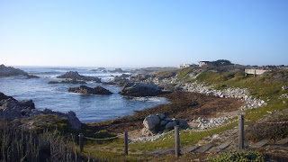
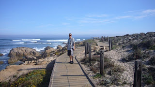
It was a warm and sunny late afternoon/evening so instead we decided to walk along the shore towards Pacific Grove, which is a small town just next to Monterey. It was absolutely gorgeous and the houses along the way were amazing! We walked for several hours but didn't quite stay long enough by the sea to see the sunset since the breeze from the Pacific got pretty chilly as the sun approached the horizon.


In the evening we did another walk to Cannery Row and Fisherman's Wharf, but didn't go for a fancy, expensive dinner even though the seafood looked delicious (we are budget travellers after all!). Our supper consisted of ham and cheese on crackers, washed down with Dr. Pepper. Yummy.

Next morning (Friday 29th August) we bought breakfast at Subway (only $5 for a footlong!) and took the most scenic route out of Monterey, i.e. through Pacific Grove along Sunset Drive (which we walked along the evening before) and via the Seventeen Mile Drive.

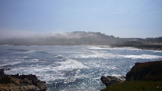
In the morning (we headed out at around 8:30) it was very foggy, but most of it cleared away as we parked on the shore in Pacific Grove and ate our subs. By the time we reached the gate to the 17 Mile Drive (yes it's a toll road but the $10 per car are well worth it) most of the fog had retreated to the sea. We have only one word to describe this scenic coastal route from Monterey to Carmel: amazing! If your're in the area it's a must drive. There are a lot of marked points of interest along the way, for instance beautiful beaches, bird rocks, lookouts and famous golf courses. The 17 Mile Drive area is the home of such well-known (at least if you play golf for real) courses as The Links at Spanish Bay, Spyglass Hill (which is open to the public) and Pebble Beach.


We can warmly recommend the 17 Mile Drive to everyone and suggest you start the drive from the Pacific Grove Gate as we did, since you then have easy access to the beachside resting points, vista points and other points of interest without having to cross the road. Also this way you don't have an extra lane to gaze over as your eyes are turned toward the shoreline and the waves of the Pacific.

Unfortunately we didn't get a good view of Pebble Beach Golf Links (much to JBB's annoyance) because there weren't any vista points and we didn't bother to stop there as there was a tournament in progress. We also missed "the Lone Cypress" which allegedly is one of California's most enduring landmarks, so we'll just have to visit both Monterey and the 17 Mile Drive in the future again! What a shame! *sarcasm*

We exited the road at the Carmel Gate, drove through smalltown Carmel along Ocean Avenue and continued south on Highway 1. It had taken us nearly 2 hours to complete the 17 miles plus the couple of miles from Pacific Grove to the starting point.

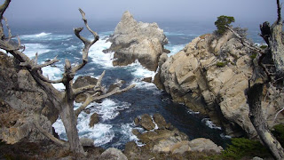
Our next stop came pretty soon, as Highway 1 passed Point Lobos State Reserve just 4 miles south of Carmel. Point Lobos S.R. is "the crown jewel of California's state park system" and has been said to be "...the greatest meeting of land and water in the world". We can certainly agree with that as the pictures will show you. Principally Point Lobos is a collection of extremely cool cliffs that the waves keep crashing into. Throw in some trees, beaches, birds, seals, sea lions and other aquatic animals and you've got a state park. We were certainly impressed. The park isn't huge, but we decided to take the car in instead of parking it half a mile short of the entrance and main gate and walk the whole way. It saved us a lot of precious time, even though the entry fee was $10 per car. On our way through the gate we once again got proof of the fact that Finland isn't such a well known country for everyone. The guard at the gate was really friendly and gave us some tips on what to go and see in the park. When he asked our nationality we answered that we were Finnish. The old man says OK and mutters something about checking to see if there are any guide booklets in our language. He half disappears begind the counter and reappers a few moments later saying "Danish! Here you go guys, enjoy your stay in the park!".

What a laugh we got driving away from the gate! The guy must have been thinking back there "What did those guys say? Something -ish, or maybe -nish... Let's see what we got here... hmm... Danish! Yes, that must be it!"

So we ended up with a Danish brochure, no harm in that, it was still readable, but funny none the less.


In the park we walked the Cypress Grove trail (Cypress Cove was spectacular, pictures above), the Sea Lion Point trail and the Bird Island trail. Although we occasionally heard the noise, we didn't see any Sea Lions on the Sea Lion Rocks due to a nasty fog that had rolled in from the Pacific. Still, we got remarkably plenty of sun while on Point Lobos and especially China Cove and Gibson Beach (pictures below) were painfully perfect in the sunlight. Bird Island was indeed very well named - it was all white from all the bird shit!


Before leaving we quickly drove to Whalers Cove, but didn't get out of the car since the place paled in comparison to the earlier sites we visited.

From Point Lobos we continued south along Hwy 1, our goal for the day being the little town (or cluster of motels if you prefer) San Simeon about 90 miles away. Between those two points the road snakes up along the steep cliffs right above the shoreline. Needless to say, the view is breathtaking. The view in the Big Sur area was particularly fantastic and the only downside was the cloud-/fogsheet lying over the Pacific. But the coast was clear and the sun was shining so we got a good look of the steep coastline plunging into the ocean. There were many vista points and turnouts where we stopped and took some pictures. Notable landmarks in Big Sur are the Bixby Creek Bridge and the Point Sur Lightstation (you can't actually drive there, but you can see the tremendous rock it lies on from Hwy 1).


We stopped for a couple of hours on the Pfeiffer Beach, which according to Drive Around California by Thomas Cook books is "Big Sur's best and hardest-to-find beach". The beach has no sign from Hwy 1 and is not visible from the road. The trick is to find Sycamore Canyon Rd, the only paved road west off Hwy 1 between the Big Sur Post Office and Pfeiffer-Big Sur State Park.


The secluded beach has some beautiful cliffs and a white strand. We enjoyed the sunshine from full horizontal positions, but didn't venture into the water due to dangerous undercurrents. (We saw one man playing ball with his two dogs and he had to rescue one of them once when it didn't have the strength to swim ashore. Another time a wave caught one of the dogs, which was turned upside down as it crashed into it. Looked very funny as four feet pointed skywards among the white foam for a moment, but not safe at all.)


From Pfeiffer Beach we drove without major stops to Hearst Castle right next to San Simeon. The beach at McWay waterfall in Julia Pfeiffer Burns State Park could have deserved a visit, but it was pretty late and paying an entrance fee again seemed excessive at that point (the fee to Pfeiffer Beach was $5 per car). Sadly we didn't have much of a view for the rest of the drive that day, as clouds and fog from the Pacific had rolled in over the coastline. The only point we saw clear blue skies at again was when the road climbed reeeeeeeally high above the clouds.


One thing to note when driving between Carmel and San Simeon along Hwy 1 is, that the distance is not long, but it takes a long time due to all sharp bends where you can't go faster than 30 km/h.

To finalize the description of the day, let's just say that we popped in to the Hearst Castle Visitor Centre (more on that in the next part), checked into our room at the Courtesy Inn motel in San Simeon, had dinner at the Manta Ray restaurant and went to bed!

*End of part 2, the last and final part will follow soon*